




Keyhole Radio

Keyhole Radio介绍
A CLOUDRF.COM ACCOUNT IS REQUIRED. FREE PLANS AVAILABLE.
Radio Engineering software for RF Engineers on the go.
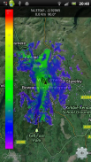
See where your radio or repeater can communicate to with the Android app from CloudRF.com.
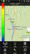
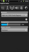
TO USE: Pan the map to zoom to your transmit site then press your menu or keypad center buttons to access the 'calculate' form. Enter your device's parameters and click the big orange button to create your coverage. Settings and help are available in the app's menu.
Full user manual available in app menu or at <a href="https://www.google.com/url?q=https://www.google.com/url?q%3Dhttps://keyhole.cloudrf.com/app/keyholeradio.html%26sa%3DD%26usg%3DAFQjCNEKLEqgfr8xZa0Wq7zCQJbs5EJI8w&sa=D&usg=AFQjCNGLtmHW6QpVvN2QqxbfsoSaaG0YkQ" target="_blank">https://keyhole.cloudrf.com/app/keyholeradio.html</a>
A CLOUDRF.COM ACCOUNT IS REQUIRED. FREE PLANS AVAILABLE.
Requirements:
* Internet connection - to communicate with server.
* GPS - to locate your position for mobile users (opt in)
Supported systems:
* Wifi, 802.11 (2.4 / 5.8GHz), TETRA, PMR, LMR, VHF, UHF, SHF, PTT, GSM, 2G/3G/LTE, DAB, DVB
Support: <a href="mailto:support@cloudrf.com">support@cloudrf.com</a>
App Features:
Transmitter
Frequency range 20 - 100,000 MHz
Effective Radiated Power 0.01 to 500,000,000 W
Coverage radius 0.1 to 100 km
Geo-location
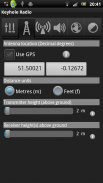
Decimal degrees
Altitude (Above ground) 0.1 to 60,000 metres
Antenna
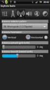
Radiation templates
8 templates in .ant v3 format
3D radiation patterns vertical and horizontal
Polarisation - Horizontal or Vertical
Azimuth and Down-tilt
Receiver(s)
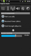
Height above ground
Received power mode (dBm)
Path loss mode (dB)
Field strength mode (dBuV/m)
IRREGULAR TERRAIN MODEL
LINE OF SIGHT
OKUMURA HATA
COST231-HATA
FREE SPACE PATH LOSS
Environment
Average ground clutter height
Custom KML clutter toggle
Terrain conductivity selection
Atmospheric climate selection
Output
Terrain Resolution (30m, 90m, 180m)
Average ground clutter height
Custom KML clutter toggle
KML clutter upload
Colour key choice
</div> <div class="id-app-translated-desc" style="display:none">一个CLOUDRF.COM帐户是必需的。免费计划内提供。
无线电工程软件在旅途射频工程师。
看到您的无线电或中继器可以与CloudRF.com Android应用程序通信。
使用方法:平移地图放大到您发送的网站,然后按你的菜单或键盘中心按钮访问'计算'的形式。输入您的设备的参数,然后点击大橙色按钮来创建你的覆盖面。设置和帮助在应用程序的菜单。
在应用程序菜单或提供全用户手册在<a href="https://www.google.com/url?q=https://keyhole.cloudrf.com/app/keyholeradio.html&sa=D&usg=AFQjCNEKLEqgfr8xZa0Wq7zCQJbs5EJI8w" target="_blank">https://keyhole.cloudrf.com/app/keyholeradio.html</a>
一个CLOUDRF.COM帐户是必需的。免费计划内提供。
要求:
*互联网连接 - 与服务器进行通信。
*全球定位系统 - 定位你的位置移动用户(选择加入)
支持系统:
* WIFI,802.11(2.4 / 5.8GHz频段),TETRA,PMR,LMR,VHF,UHF,SHF,PTT,GSM,2G / 3G / LTE,DAB,DVB
技术支持:<a href="mailto:support@cloudrf.com">support@cloudrf.com</a>
应用特点:
发射机
频率范围20 - 10万兆赫
有效辐射功率0.01 500,000,000W¯¯
覆盖半径0.1至100公里
地理位置
十进制度
海拔高度(地上)0.1至6万米
天线
辐射模板
8模板赵军阳张志利中V3格式
三维辐射图的垂直和水平
极化 - 水平或垂直
方位角和向下倾
接收器(多个)
离地高度
接收功率模式(dBm的)
路径损耗模式(DB)
磁场强度模式(dBuV / M)
不规则地形模型
视线的
OKUMURA HATA
COST231-HATA
免费空间路径损耗
环境
平均地面杂波的高度
自定义KML杂波切换
地形选择电导率
大气环境的选择
产量
地形分辨率(30米,90米,180米)
平均地面杂波的高度
自定义KML杂波切换
KML杂波上传
彩色钥匙的选择</div> <div class="show-more-end">


